Spinnakers to Barnard Park
Victoria West Walk #3 (as revised at Jan. 18, 2004)
A one-way walk starting at Spinnakers’ Brew Pub and ending at the border with Esquimalt just west of Barnard Park. West Song Walkway – Mary – Russell – Rainbow Park – Robert – Seaforth – Maitland – West Song Walkway again – Barnard Park.
Start at Spinnakers’ Brew Pub. In the nineteenth century, there were native fishing shacks where the Pub now stands. Spinnakers opened in 1984 in a refurbished and enlarged house built in 1918.
The Pub is next to Lime Bay, where a lime kiln once operated to provide construction materials for the growing city. Lime Bay once extended almost to the Esquimalt & Nanaimo Railway tracks but was partially filled in in the 1950’s.
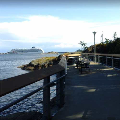
The name West Song Walkway is derived from “Songhees,” the native band who lived here from 1850 to 1911, and “West Bay,” where the walkway ends. Follow the walkway west to Mary Street, and turn up Mary. At the foot of the street a powder magazine was established in the late 1800’s.
Number 211 Mary Street was the home of Elizabeth Bland and her husband. Her parents headed a wealthy family that owned Halfway House, an inn midway between Fort Victoria and Esquimalt Harbor. Halfway House was where the camels were quartered that were tested as beasts of burden in the Cariboo during gold rush days, 1858-1861. Across the street, at 222 Mary, is an attractive brick house built in 1890 by a Mr. Wilkinson, eldest son of the Anglican Bishop of Northern and Central Europe. The house was built of local brick. It has been restored, and the surrounding townhouses built to harmonize with it are one of Victoria’s better examples of preserving the old while building new.
Farther up Mary Street on the left is Ormond’s Biscuit Factory. Originally it made crackers and biscuits, but then bread was added to the product list, and by 1901 the factory was baking 40,000 loaves a month. The factory was ahead of its time in making deliveries. Delivery customers included the Work Point Barracks, enabling Ormond’s to call themselves, “Bakers to Her Majesty’s Troops.” A polar expedition bought pilot biscuits here, and dog biscuits for their huskies. Though not officially designated, the factory is one of the few remaining industrial heritage buildings in Victoria.
Go up to the railway tracks and turn left to get to Russell Street. The tracks belong to the Esquimalt & Nanaimo Railway, constructed by James Dunsmuir to bring coal from his mid-Island mines to Esquimalt Harbor. In 1886 the line was extended to Russell Station, and later to its present downtown terminus at Store Street.
Robert John Russell arrived in 1853 on the Norman Morison. As an employee of the Puget’s Sound Agricultural Company (PSAC), he bought land at 1 pound an acre and later sold parcels in what he called the Springfield Estate. Land prices rose during the Fraser River and Cariboo gold rushes but collapsed in 1864 when the gold boom proved short-lived. Speculators were left with land inventories that could not be sold until the economy improved.
At the foot of Russell Street and extending to Robert Street is Rainbow Park. The Canadian Navy was established in 1910. Its first ship was HMCS Rainbow, built in England in 1891 and sailed from Portsmouth around Cape Horn to Victoria. The Rainbow was scrapped in Seattle in 1920. A rowing club was built here for the James Bay Athletic Association (JBAA) in 1938, and the building later became the home of the Rainbow Sea Cadets. A pillar from the old building is still visible in the rocks at the water’s edge. Modern-day Rainbow Estates were built here after the old JBAA building was torn down.
Continue to Robert Street. At the end of the street is Coffin Island, a First Nations burial site. The east side of Robert Street was owned by the Muirheads; the west side, by the McBeaths. Number 223 Robert was the family home of James Muirhead, Jr., whose father owned a sawmill downtown close to Capitol Iron. The house was designed by Thomas Hooper. Restored by the present owner, it has the distinction of being the only privately-owned house in British Columbia designated a National Historic Site.
Across the street, at number 230 Robert, is another Thomas Hooper design. Among its interesting features is a bay window angled to gain a water view. The view is now obscured by trees. The house was built for Duncan and Ursula McBeath, but Ursula did not like it. The couple moved up the street to another house, at the corner of Seaforth, but it was not the one that stands there now. When their house came down in 1978, the interesting house that now occupies the site was moved from the corner of Seaforth and Maitland one block away. This house, called Huntingdon Cottage, dates from 1888. In 1907 it was sold to Duncan and Eliza Stewart, who influenced a change of street names in the neighbourhood. William Street became Seaforth, and James Street became Maitland. Duncan Stewart was from Seaforth, Ontario, and Eliza was from Huntingdon, Quebec (which is near Maitland, Ontario).
Number 614 Seaforth is built in the bungalow style. The north-facing verandah is reminiscent of India, where this orientation offered the most protection from the sun. The Princess Patricia apartments stand at the junction of Seaforth and Maitland. They occupy the site of the former home of Captain James Troup, who managed the BC Coast Steamship Service from 1901. From here he could watch his ships enter and exit the harbor. It was he who initiated the practice of naming the fleet for princesses.
Descend steps at the foot of Maitland to a gazebo on the West Song Walkway. Henry Simpson once owned the land where the gazebo stands. He came over on the Norman Morison in 1853 with John Russell. A baker, Simpson made his home on the Constance Cove Farm where the Canadian Forces Base now stands. Simpson bought not only this shoreline as far as Barnard Park but also 300 acres in North Saanich where in 1864 he opened the Prairie Inn.
Continue along the walkway to Barnard Park. Sir Frank Barnard was Lieutenant Governor of British Columbia during World War I. In 1900 he built Clovelly, named for a town in Devon, on the site where the tennis courts are now. Remnants of the brick pillars at the entrance are visible today. Lady Barnard, Sir Frank’s wife, was a stylish woman descended from the Loewen family of Prussia. After the sinking of the Lusitania in 1915, anti-German rioting broke out in Victoria. Unfounded rumor had it that Lady Barnard had raised her glass and toasted the Kaiser when the ship went down. A mob started up Rockland toward the Lieutenant Governor’s house, but the police turned them back. After Lady Barnard died, Clovelly became a nunnery and then a boarding house.
Go up Sea Terrace to its junction with Dunsmuir. At this point you will have left Victoria West and entered Esquimalt. Esquimalt and Victoria West had held the three farms – Craigflower, Viewfield, and Constance Cove – established by the PSAC in the 1850’s. The farms were to supply not only Fort Victoria but others as well. The PSAC had contracts to supply food to the Russians in Alaska, and, once the Oregon Territory was lost to the Americans in 1848, Victoria was to be the new source of produce. Part of the boundary between Victoria West and Esquimalt follows the boundary of Constance Cove Farm. The Esquimalt and Victoria West farms were ultimately sold off by the Hudson’s Bay Company.
(Note: We thank John Adams, historian and author, for his assistance in developing this walk. John conducts walking tours through Victoria’s many neighbourhoods. For his current tour schedule consult www.discoverthepast.com).