Front Street to Harbourfront
Victoria West Walk #2 (as revised at December 23, 2003)
A one-way walk beginning at the elementary school on Front Street and ending on the harbourfront at the Delta Ocean Pointe Resort. Front – Russell – Langford – Catherine – Songhees harbourfront – Delta Ocean Pointe Resort.
Start at Victoria West Elementary School, 750 Front Street. Front ends at Russell Street, named for Robert John Russell, who arrived on the Norman Morison in 1853 and worked on the farms of the Puget’s Sound Agricultural Company (PSAC) in what is now Esquimalt. He saved his money and became a sizeable landholder, buying land when it was offered by PSAC’s parent Hudson’s Bay Company at a pound an acre.
The School is situated above the low ground that drained across the Esquimalt School grounds and into the Gorge at Kinsmen Park. The area, known as Skinner’s Bog, would flood and freeze over in winter, making it a popular skating pond.
Across from the School, on the north side of Langford between Russell and Mary, was the home of the Semples. The family were actors and opened a theater on their grounds called Semple’s Hall.
Ascend Langford and turn right on Catherine. At the corner of Edward and Catherine was the old fire hall. The Anglican Church of St. Saviour’s, at Henry and Catherine, dates from 1891. Its parishioners included military personnel from Work Point Barracks. An older church built by the Methodists once stood on the east side of Catherine at Wilson, and the former St. Paul’s Presbyterian Church, built in 1890, occupied the southeast corner of Henry and Mary. Settlers would come across the harbour from James Bay by boat to attend services at St. Paul’s. Methodists and Presbyterians amalgamated in the 1920’s to form the United Church. The building to which they moved on Fullerton is now the Salvation Army High Point Community Church.
Where Bay and Dundas join Catherine, there is an attractive sturdy stone building on the left (#225 Dundas). Now the Vic West Medical Centre, it was built in 1908 as the Victoria West Branch No. 2 of the Royal Bank of Canada.
At the junction of Catherine and Esquimalt Road, the white brick building on the right dates from around 1909 and was originally part of the Silver Spring Brewery. Before that, the site had been occupied by the Fairall family’s soda shop and brewery.
Continue across Esquimalt Road to Spinnakers’ Brew Pub. The small cove next to Spinnakers is what remains of Lime Bay. After Fort Victoria (then Fort Camosun) was established in 1843, lime for construction was brought in by barge and deposited here. The lime kiln itself was above where Kimta Road lies today. The bay was once much larger but was filled in stages from 1935 to the late 1950’s to allow development.
Lime Point, between Lime Bay and Mud Bay to the east, was an aboriginal defensive site. It was likely protected by a trench dug across the closed end of the small peninsula between the bays. There is no record of the Songhees (Lekwungen) actually living here in historic times. One of the more prominent Songhees family groups lived in Cadboro Bay, and oral histories mention earlier villages in a number of bays around Victoria’s outer coast as well as in Esquimalt harbour and the Gorge narrows area. The defensive position at Lime Point would have protected parties that came here to fish or set out for clam, oyster, and mussel grounds around the inner harbour. After Fort Victoria was established and the Songhees had positioned themselves in Victoria West, they and other First Nations became part of the European wage economy. They worked to buy goods for their own consumption and for distribution at potlatches. In the early years of the Fort the Europeans were dependent on the Songhees for much of their food supply.
In the mid-1800’s, when Fort Victoria itself was but a small community, the Songhees Reserve in Victoria West was a thriving commercial and social centre. There were 500 to 700 permanent residents and as many as 5,000 annual visitors who camped in the area at various times of the year. After 1862, with establishment of the City of Victoria, the aboriginal population became a minority of the total, but still played an important role in the local economy.
Tragically, the year 1862 also brought smallpox, carried by a visitor from San Francisco. Dr. Helmcken had inoculated the Songhees, but itinerant First Nations from the far north – Haida, Tlingit, Tsimshian, Bella Bella – were unprotected and unknowingly infected their families. Historians estimate that up to a third of Vancouver Island’s First Nations population died in the epidemic.
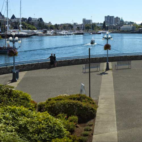
Proceed toward Victoria along the waterfront to a small plaza with a fountain flanked by two small statues. This was the location of Mud Bay, a favorite beach for visiting First Nations, especially after the 1870’s. Condominiums were built here in the early 1990’s.
Continue to Songhees Point, where the two carved poles stand today. Across the harbour, beneath Victoria’s Wharf Street, one can make out a reinforced stone wall. This is part of the back wall of the Hudson’s Bay Company fur storage building. To the right is a handsome pink building – the Empire-style Malahat Building or Customs House (#1002 Wharf Street). Built in 1874-75, this is the oldest building west of Winnipeg belonging to the federal government. Mineral claims had to be filed here, and, when gold was discovered in the Klondike in 1897, it is said that the line of gold seekers at the Customs House stretched for miles.
In 1859 the Royal Hospital was built on Songhees Point. It was used by both European and First Nations patients. In 1869 the hospital and the Women’s Infirmary, established on Pandora Street in 1864, were amalgamated into a new Royal Hospital at the Pandora Street location. The combined facility was moved yet again, in 1890, to the present Royal Jubilee Hospital site.
Meanwhile, the building that had originally housed the Royal Hospital on Songhees Point reopened in 1872 as an “Asylum for the Insane.” Two years later another hospital – the Marine Hospital serving mariners only – was built just north of the Asylum and south of today’s Delta Ocean Pointe Resort.
Its position at the mouth of the harbor made Songhees Point an all-too-desirable location for early industries. Sidney Tar, a company producing mainly tar paper and roofing tiles, was built across the former sites of the Asylum and the Marine Hospital. The neck of land on the other side of the harbour entrance, where the Laurel Point Inn stands today, was originally a First Nations above-ground burial site. It later hosted a soap factory and then a paint factory. Contaminants were removed or covered by landfill in a modern beautification campaign.
The Delta Ocean Pointe Resort is also built on landfill, obtained from dredging under the Johnson Street Bridge to allow ships to pass into the upper harbour. As engineers strived for compromise between strength and movability, four different bridges evolved – simple trestle, trestle with manually operated lift feature, pivot, and finally the present seesaw or bascule bridge. The present bridge was built in 1931, by the same company that was to construct San Francisco’s Golden Gate Bridge six years later.
(Note: For assistance in preparing this walk, we are indebted to Grant Keddie, Curator of Archaeology, Royal British Columbia Museum, and a resident of Victoria West. His new book, Songhees Pictorial, A History of the Songhees People as Seen by Outsiders, 1790-1912, was published early in 2004.)